São Tomé Island (São Tomé)
São Tomé Island is about 48 km long (north-south) by 32 km wide (east-west). It rises to 2,024 m at Pico de São Tomé and includes the capital city, São Tomé, on the northeast coast. The nearest city on mainland Africa is the port city of Port Gentil in Gabon located 240 km to the east.
The island is surrounded by a number of small islands, including Ilhéu das Rolas, Ilhéu das Cabras and Ilhéu Gabado.
Map - São Tomé Island (São Tomé)
Map


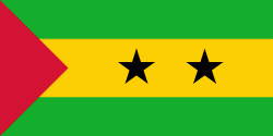
Country - São_Tomé_and_Príncipe
 |
 |
It consists of two archipelagos around the two main islands of São Tomé and Príncipe, about 150 km apart and about 250 and 225 km off the northwestern coast of Gabon. With a population of 201,800 (2018 official estimate), São Tomé and Príncipe is the second-smallest and second-least populous African sovereign state after Seychelles.
Currency / Language
| ISO | Language |
|---|---|
| PT | Portuguese language |